About the Reserve
A community-governed Crown Land Manager working the Lightning Ridge opal fields since our establishment under the Crown Land Management Act 2016 (NSW).
Who we are
Crown Land Manager for the Lightning Ridge Opal Fields
The Lightning Ridge Area Opal Reserve (LRAOR), formally The Trustee for Lightning Ridge & Surrounding Opal Fields Management Reserve Land Manager, ABN 22 866 447 410, is a delegated Crown Land Manager appointed under the Crown Land Management Act 2016 (NSW). We are responsible for the on-ground management of Crown land across the Lightning Ridge opal fields.
Our role is practical and on-the-ground: maintaining roads and access, stewarding natural assets, supporting community programs, and facilitating productive and responsible use of the Reserve. Revenue generated by the Reserve is reinvested directly into local infrastructure and community projects, not distributed as profit.
We are not a regulator.
Statutory approvals, licensing and enforcement relating to mining and resources are the responsibility of Crown Lands NSW and the NSW Resources Regulator, not LRAOR. If you have a regulatory matter, please contact those agencies directly.
The Reserve is governed by a Board of seven members representing the local mining community, landholders and broader stakeholders of the Lightning Ridge area. Day-to-day operations are managed by a small, dedicated staff team based in Lightning Ridge.
Key facts
- Legal name
- The Trustee for Lightning Ridge & Surrounding Opal Fields Management Reserve Land Manager
- ABN
- 22 866 447 410
- Status
- Delegated Crown Land Manager under the Crown Land Management Act 2016 (NSW)
- Governance
- Board of 7 community-representative members
- Based in
- Lightning Ridge, NSW 2834
- Revenue use
- Reinvested into local infrastructure and community projects
Our region
Where We Work
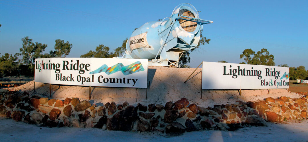
The Reserve spans Crown land across the Lightning Ridge opal fields in north-western New South Wales, within the Walgett Shire. The opal fields are among the most significant in Australia, a working landscape where miners, farmers and communities have lived and worked for generations.
Our area of responsibility encompasses the opal fields around Lightning Ridge itself, as well as the surrounding communities of Grawin, Glengarry, Sheepyard, Goodooga and the regional centre of Walgett.
The opal fields are a mosaic of active mining claims, pastoral runs and natural bushland, all Crown land, managed in the public interest. The terrain is characterised by red-dirt tracks, scattered mulga and cypress pine, seasonal waterways including the Narran River system, and the distinctive mine mullock heaps that define the Lightning Ridge landscape.
Managing this landscape requires close collaboration with miners, landholders, local government, state agencies and the broader community, which is exactly how we work.
Why we exist
Our Purpose
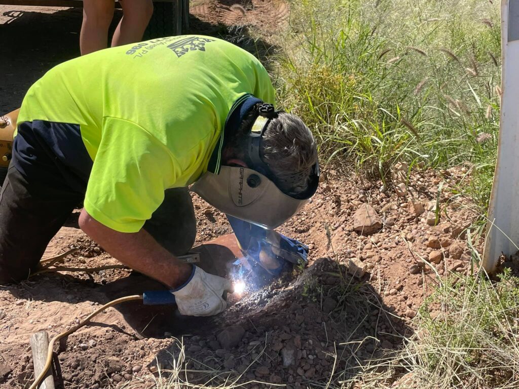
Land Stewardship
Maintaining roads, access tracks, water points and community facilities across the Reserve. Looking after Crown land so it continues to work for miners, residents and visitors today and into the future.
Community Programs
Supporting education, youth programs, research partnerships and Indigenous-led initiatives. Revenue from the Reserve is reinvested locally, in projects that benefit the whole Lightning Ridge community.
Environmental Care
Active weed control, feral animal management and biocontrol programs, including the Hudson Pear cochineal release. Working to keep the opal fields healthy for the long term.
The people
Governance & Team

Meet the Board
Seven community-representative directors responsible for the governance and strategic direction of the Reserve. The Board meets regularly and all positions are voluntary.
Board of Directors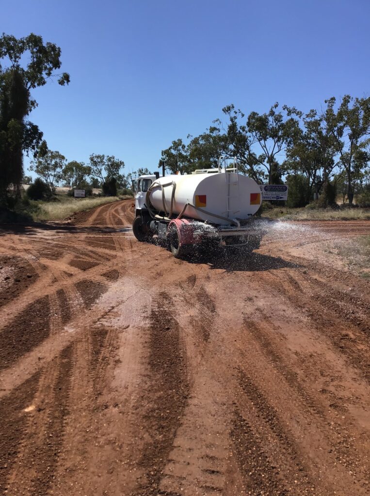
Meet the Staff
A small, dedicated team based in Lightning Ridge responsible for the day-to-day operations, land management and community programs of the Reserve.
Our staffGet in touch
Questions about the Reserve?
Our team is based in Lightning Ridge and happy to help. Whether you have a general enquiry, a community proposal, or a media request, get in touch.